Transport has played a fundamental role in the development of the area now known as Sandwell.
Long before the modern borough was created in 1974, the towns of Smethwick, Oldbury, West Bromwich, Wednesbury, Tipton and Rowley Regis were developing independently. Their eventual transformation from settlements surrounded by farmland into densely populated industrial communities depended heavily upon the ability to move raw materials, manufactured goods and people.
The story can still be read in the landscape today. Canals pass through deep cuttings and beneath historic bridges. Railway lines follow routes established during the nineteenth century. Roads cross former industrial districts, while the West Midlands Metro has brought tram travel back to parts of the borough.
Together, these networks helped shape modern Sandwell.
Before the railways
Before railways transformed nineteenth-century travel, roads provided the principal overland connections between settlements.
But moving large quantities of coal, iron, limestone and manufactured goods by road was expensive and difficult.
The development of the canal network provided industrialists with a much more effective means of transporting heavy materials.
Sandwell Council’s historical assessment of the borough identifies the development of its extensive canal network as an important element of early industrialisation. Factories and workers’ housing subsequently developed around industrial sites and transport corridors.
The canals transform the landscape
The Birmingham Canal was authorised in 1768, with the original route opening by 1772. It eventually became part of the extensive Birmingham Canal Navigations network.
Coal was among the principal commodities transported along these waterways.
During the 1820s and 1830s, engineer Thomas Telford carried out a major modernisation of the Birmingham Canal system. His straighter New Main Line reduced journey distances and created some of the most impressive surviving pieces of transport engineering in the area.
The resulting landscape is particularly striking around Smethwick and Galton Valley, where different generations of canal and railway engineering occupy the same narrow corridor.
The canals did more than carry goods through the area. Industry increasingly clustered beside them, allowing businesses to receive raw materials and dispatch finished products more efficiently.
Galton Bridge
One of Sandwell’s outstanding transport structures is Galton Bridge in Smethwick.
Designed by Thomas Telford and completed in 1829, the cast-iron bridge crosses the deep cutting of the Birmingham Canal New Main Line.
Its single span measures approximately 150 feet, and Historic England records that the bridge was manufactured by the Horseley Iron Works. It was named after Samuel Tertius Galton, a member of the Birmingham Canal Navigations committee.
Today Galton Bridge is Grade I listed.
The surrounding Galton Valley is particularly important because canals, roads and railways developed at different levels, creating an extraordinary concentration of transport infrastructure.
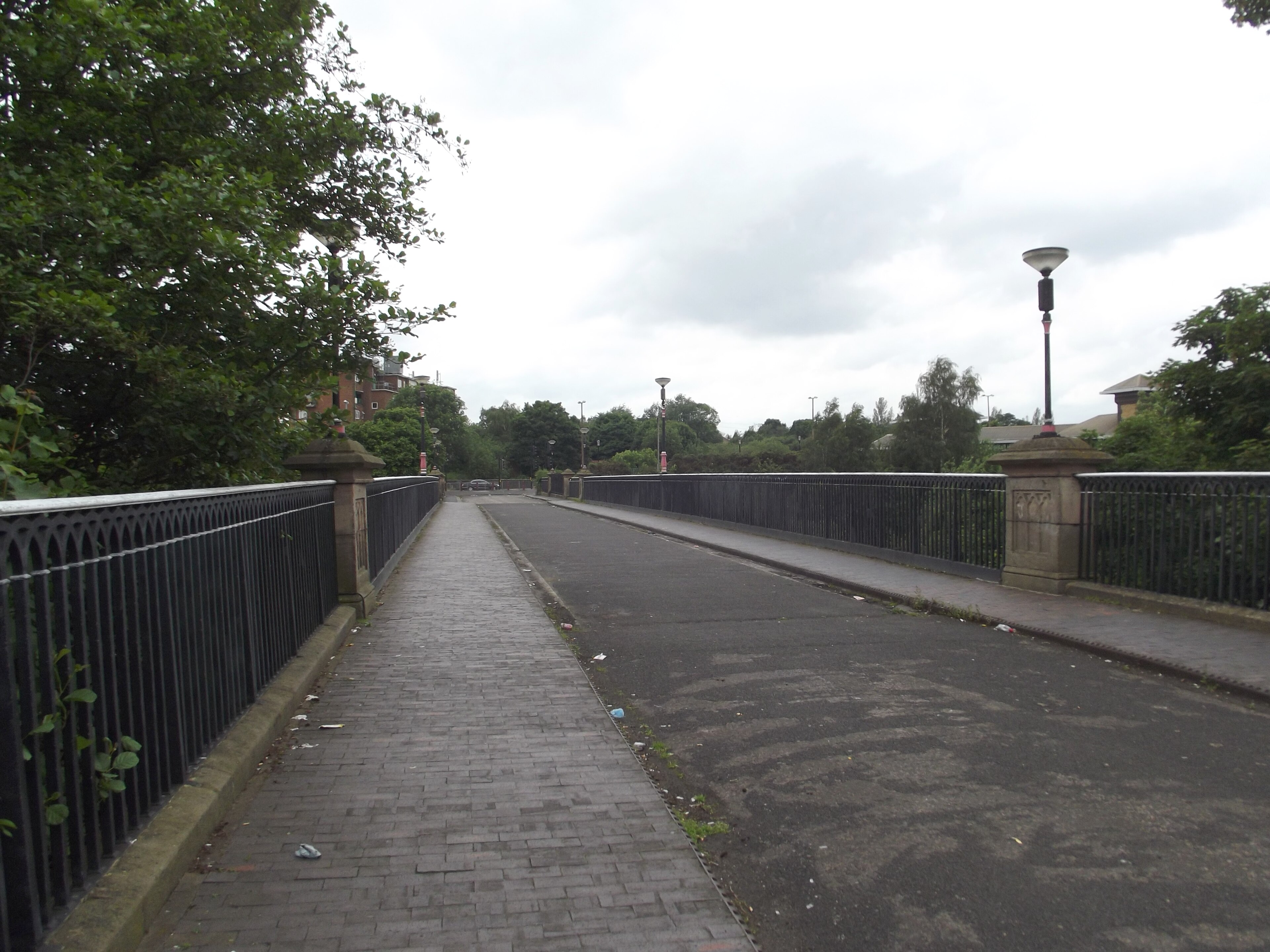
Galton Bridge crossing the Birmingham Canal New Main Line at Smethwick.
Image credit: Photograph: Elliott Brown · Source: Wikimedia Commons · CC BY 2.0 · Image date: 14 June 2012
The arrival of the railway
Railways brought another major change during the nineteenth century.
The Birmingham, Wolverhampton and Stour Valley Railway opened through Smethwick in 1852. The Stourbridge Extension Railway followed in 1867, providing a route linking Smethwick with Old Hill and onwards towards Stourbridge.
Railways increasingly handled long-distance transport, but they did not immediately make the canals redundant.
For decades the two systems worked alongside one another. The Galton Valley conservation-area research records that railway companies and canals became closely interconnected, with transhipment depots allowing goods to be transferred between the two networks. Canals remained particularly useful for carrying materials to industries established beside their banks.
Railway development also encouraged further industrial growth. The historic landscape study for the Black Country records stations at Dudley Port and Oldbury and notes the establishment of the Oldbury Railway Carriage and Wagon Works in 1854.
Railways across the six towns
The railway network eventually connected communities across what would become Sandwell.
Stations and railway corridors served Smethwick, Oldbury, Tipton, Rowley Regis, West Bromwich and surrounding industrial districts.
Although closures and redevelopment changed the network during the twentieth century, railways remain an important part of Sandwell’s transport system.
Today the borough has 12 railway stations, including Smethwick Galton Bridge, Smethwick Rolfe Street, Sandwell & Dudley, Langley Green, Rowley Regis, Old Hill, Tipton and Dudley Port.
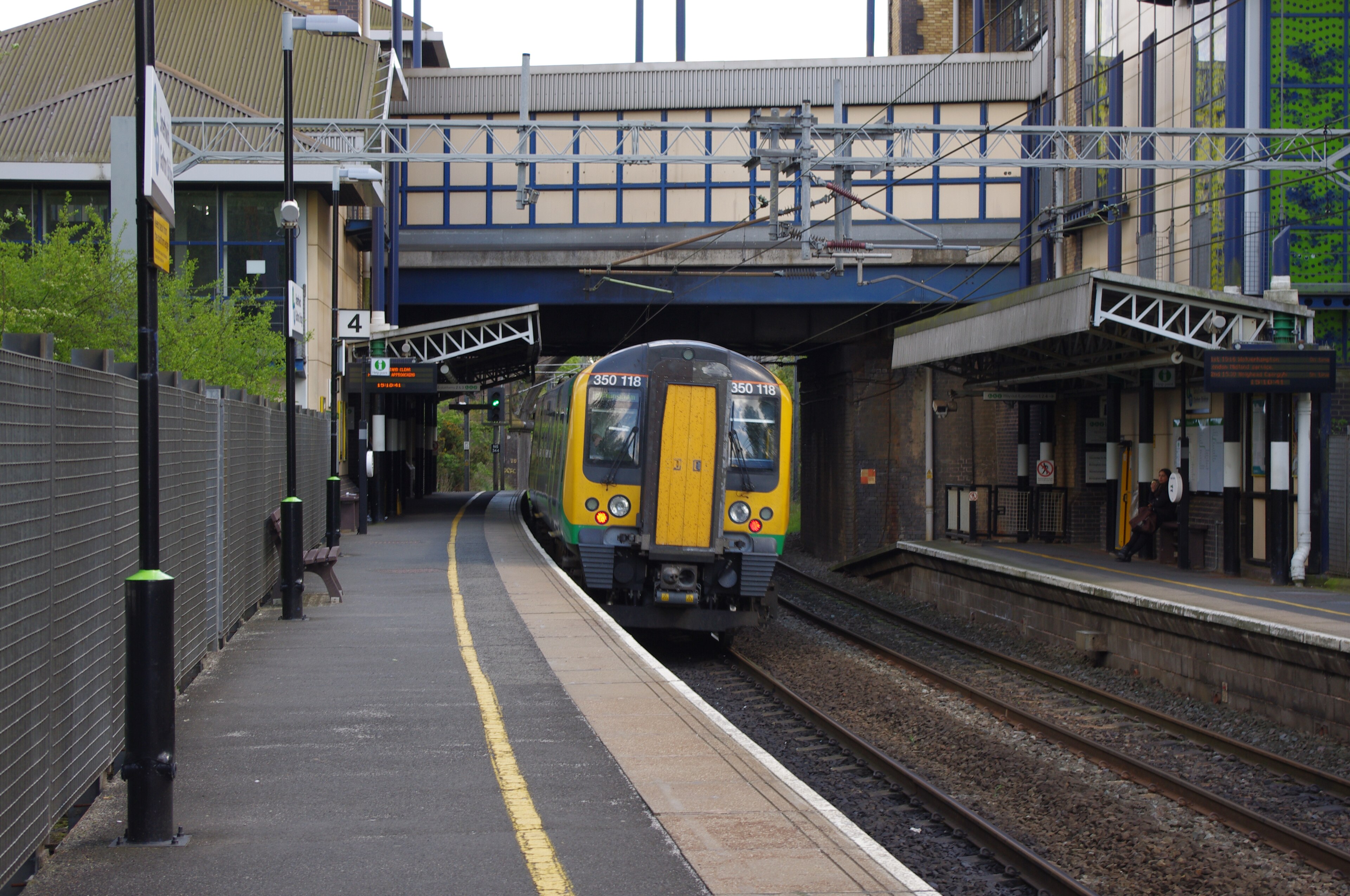
A Class 350 train at Smethwick Galton Bridge railway station in May 2012.
Image credit: Photograph: TheJRB (Joshua Brown) · Source: Wikimedia Commons · CC BY-SA 2.0 · Image date: 12 May 2012
Tramways and public transport
Railways were not the only form of public transport to change Sandwell.
During the late nineteenth and early twentieth centuries, tramways became an important feature of urban travel across the Black Country.
Trams helped connect growing residential areas with town centres and industrial workplaces. They belonged to a wider transformation in everyday mobility: journeys that had once been made principally on foot could increasingly be undertaken using organised public transport.
Traditional street tramways eventually disappeared as buses and motor vehicles became dominant.
However, tram travel later returned to the Black Country through the West Midlands Metro, once again connecting parts of Sandwell with Birmingham and Wolverhampton.
Roads and the motor age
During the twentieth century, road transport became increasingly important.
Cars, buses and commercial vehicles changed both the way people travelled and the way goods were distributed. New and widened roads altered older street patterns, while major road schemes were constructed to cope with increasing traffic.
Perhaps the most dramatic example is the M5 motorway, whose elevated sections became a major feature of the landscape around Oldbury and West Bromwich.
The result was another layer added to Sandwell’s transport landscape.
Canals, Victorian railway lines, twentieth-century roads and modern public transport systems can sometimes be found within remarkably short distances of one another.
Bridges as evidence of the past
Sandwell’s many bridges provide particularly visible evidence of this complicated transport history.
They carry roads across canals, railways across waterways and modern highways across older transport corridors.
Sandwell Council currently records responsibility for 178 bridges, while many others within the borough are maintained by organisations including Network Rail, the Canal & River Trust, Transport for West Midlands and National Highways.
Some are functional modern structures. Others are important pieces of industrial archaeology.
Galton Bridge is the outstanding example, but canal bridges, railway bridges and surviving structures throughout the borough collectively reveal how densely interconnected the Black Country became.
From industrial transport to heritage
The original purpose of many of these transport networks has changed.
Commercial canal traffic declined substantially as railways and eventually road haulage became more efficient for many types of freight. Industrial sites beside the waterways closed or were redeveloped.
Yet much of the infrastructure survived.
Sandwell still contains more than 30 miles of canals, according to the council, and sections of the network around Smethwick and Tipton are protected for their historical significance.
Formerly industrial waterways have become walking routes, wildlife corridors and places from which the area’s industrial history can be explored.
A landscape built around movement
Transport did not simply connect Sandwell’s towns after they developed.
It helped create the conditions in which they developed.
Canals encouraged factories to establish themselves beside waterways. Railways opened new connections for manufacturers and passengers. Tramways and buses allowed workers to travel greater distances, while twentieth-century roads changed how businesses and communities interacted with the wider region.
The resulting landscape is layered rather than belonging to one particular period.
A walk through Sandwell can take someone beneath a motorway, alongside a nineteenth-century railway and onto a canal engineered during the Industrial Revolution within a matter of minutes.
Those overlapping networks are among the clearest surviving reminders of how transport helped transform the Black Country.
Sources & Further Reading
Sandwell Council — Historic Evolution
Historic England — Galton Bridge
Historic England — Canal and River Navigations National Overview
Sandwell Council — Smethwick Town Centre Conservation Area Character Appraisal
Sandwell Council — Smethwick Summit & Galton Valley Conservation Area Appraisal